BCIT Drone Demo with Eric Saczuk
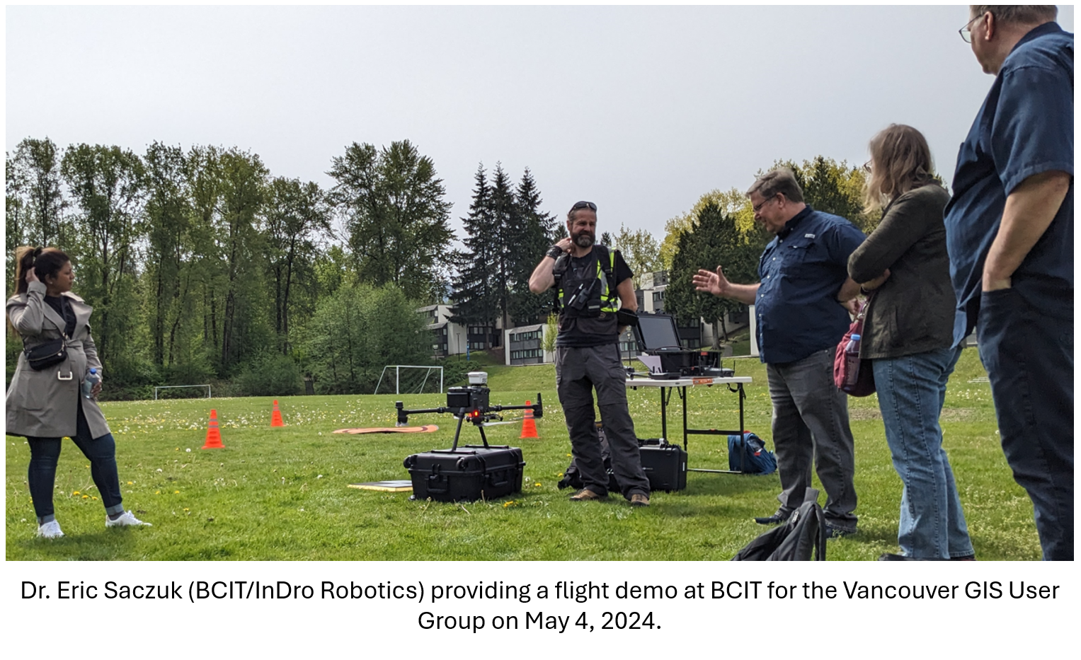
On Saturday, May 4th, 2024, Dr. Eric Saczuk (BCIT/InDro Robotics) conducted a flight and application demo of the M350 RTK and DJI Mavic 3 Enterprise drones. The event was hosted by the Vancouver GIS User Group.
Eric is the Director of the RPAS Hub at BCIT & also Flight Operations Lead and Chief Pilot at InDro Robotics where he conducts specialized drone operations around the globe. Saturday's demo included a multi-spectral photogrammetry image capture flight using a DJI Mavic 3 Enterprise, demonstration of the SoarAbility 4D gas sniffer, and a demo of the larger DJI M350 aircraft with interchangeable optical/LiDAR/FLIR payloads.

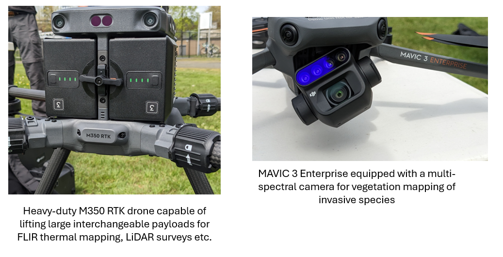
During the demo Eric was able to showcase the DJI M350 RTK drone and the DJI Mavic 3 Enterprise equipped with a multi-spectral camera. The M350 RTK drone is a heavy-duty unit capable of interchangeable payloads for LiDAR, FLIR, and many other customized payloads.

The M350 RTK drone works as an RTK rover for high accuracy/high precision LiDAR mapping. Most of their applications include LiDAR surveys for geomorphology, stream channel assessments and related applications where x, y, and z data is important. The M350 is also capable of FLIR thermal surveys and mapping. This is incredibly useful for identifying potential cold-water refugia sites in large rivers for salmon and trout.
The Mavic 3 drone, which is also RTK-enabled, is useful for orthographic surveys and mapping where a more portable unit is required. It is equipped with color and multispectral cameras meaning that imagery is captured in the visible spectrum as well as separately in Red and Green, bands in addition to red-edge and near-infrared which are invisible to the human eye. Vegetation looks quite a bit different when viewed through multispectral imagery and can therefore be mapped and classified more easily with band combinations rather than with simple RGB orthographic imagery.
As cool as drones are, the collective cost of the more advanced hardware is quite steep. I encourage everyone to familiarize themselves with the process of structure-from-motion (SFM)/photogrammetry. Cheaper consumer DJI models purchased at London Drugs, for example, can produce basic ortho-mosaics from RGB imagery, but it's probably a good idea to connect with someone like Eric for more advanced surveys that require LiDAR, thermal etc. BCIT RPAS Program contact details.
If anyone else is interested in desktop-based tips and tricks for leveraging RGB/ortho drone data post-processing in aquatic ecosystems for hydrology, fish habitat assessments etc., I also offer a short half-day course on tips and tricks accumulated over the years (Leveraging Drone Imagery for Surveying and Environmental Monitoring in British Columbia).

