Stream Network Models
Spatial Stream Network (SSN) Applications with the BC Freshwater Atlas
Working towards better tooling and infrastructure to efficiently work with stream network data in British Columbia
Summarizing environmental attributes across stream reaches with GIS and statistical models can be challenging. Spatial autocorrelation patterns reflect a branching networks with upstream and downstream hydrological connectivity and varying flow volumes at the confluence of tributary and mainstem reaches Conventional GIS tooling (e.g., intersections, zonal statistics, etc.) and conventional statical models, such as regression, (often) fail to account for these features.
Spatial Stream Network (SSN) Models: SSN models are a special class of statistical tools for regression that are specifically designed to incorporate network connectivity, flow direction, and flow volume. Sites can be considered flow-connected or unconnected with different types of relationships SSN models are used to model a variety of parameters within statistical/correlative modelling applications. Spatial Stream Network (SSN) Resources.
Examples of SSN Models in Practice: Common use cases for SSN models include predicting stream temperature across large basins. However, many other applications exist to predict various water quality parameters (e.g., conductivity, pH), geomorphic metrics, and aquatic biota etc. Any regression model with reach and basin-level attributes can be turned into an SSN model SSN models often (but not always) show better fit and predictive performance.
Adoption and use cases of SSN models in Canada remain limited: Despite potential value (and advantages), SSN model applications in BC/Canada remain limited relative to the USA. Why is this the case?
- Custom stream network development (i.e., starting from scratch with a DEM) with poor linkages to existing hydrological datasets.
- Difficulties generating meaningful environmental predictor variables (custom generation in external tooling).
- Manually linking (snapping) site observation data and associated QA/QC.
- USA applications can readily leverage the NHDPlus stream network data infrastructure with hundreds of pre-processed basin-level and stream reach predictor variables from StreamCat.
BC-FWA (far from perfect) but is the authoritative cartographic source for freshwater features in BC. Contains all the necessary features for SSN but requires heavy-duty pre-processing. This project leverages the existing BC-FWA and makes an nessessary edits for SSN stream network modelling (see video for details). This work involved identifying mainstem routing paths and dendritic mainstem segments. Additional work went into modifying the FWA_WATERSHEDS_POLY to create functional RCA (reach contributing area polygons) - these units are essential for summarizing environmental attributes.
The final data product consists of analysis-ready SSN model objects from the BCFWA named watersheds layer. The final data product preserves all attributes from the BCFWA streamline layer, but makes input data ready for stream network modelling. See access download link below.
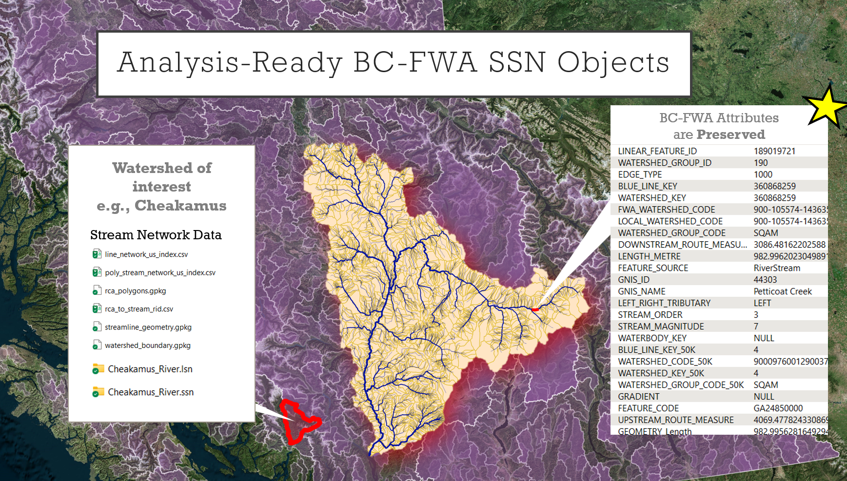
Pre-processed SSN Data Objects for all Watersheds within British Columbia
Basin-level Regression Equations and area-based Metrics: Basin-level regression equations need informative environmental predictor variables (covariates). There was a need for an easy, efficient, and repeatable process to generate environmental upstream summaries of environmental variables continuously along the stream network. Examples of area-based metrics: Upstream drainage area, mean elevation, MAP, road density, etc. The best way to close this gap was through the development of a custom R package that fullfilled many of the accumulation functions in openSTARS and STARs (now depreciated).
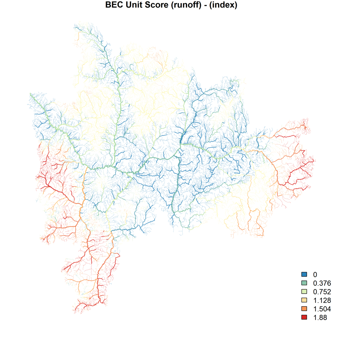
Accumulative upstream summaries for any parameter of interest
SSNenvSummary: Vector-Based Upstream Summaries with a new custom R package Vector-based upstream and downstream network summaries of environmental attributes (same functionality as NetMap). High-speed upstream summaries with DB tooling: % upstream coverage, weighted mean by area (e.g., mean basin elevation), linear density, point density etc.
GitHub Repo. Link: https://github.com/mattjbayly/SSNenvSummary
Finally, we can put all the pieces together into a clean, efficient, and repeatable process. First, we identify a target watershed of interest. Then we download the preprocessed SSN and LSN objects derived from the BC-FWA. These data files are ready for modelling in SSN2 via the SSNbler R package. Next, we use the SSNenvSummary R-package to add custom environmental predictor variables. Finally, we run our SSN model for any parameter of interest.
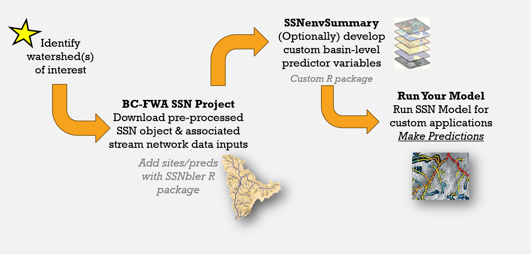
General workflow
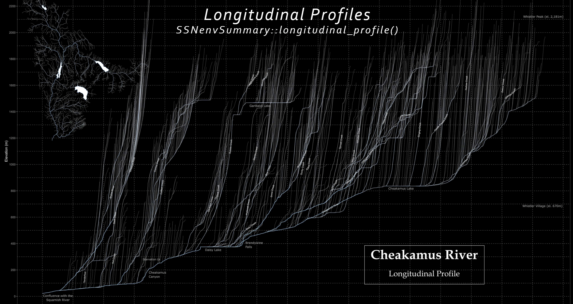
With the SSNenvSummary R package we can also do other interesting things, such as creating longitudinal profiles
Download functionality from this application is still under development. For early release please email info@mjbayly.com to manually request data for a watershed of interest…