Chilcotin River Landslide July 31, 2024 Update
Sometime in the early morning hours of July 31st (2024), the Chilcotin River was blocked by a massive landslide. The landside stretches about 500 m wide and extends for about 1.06 kilometres. The total area of the landslide is about 0.53 square kilometres (as measured by satellite imagery, details below). As of July 31st 2024 water continued to be impounded upstream of the landslide and the Chilcotin River has run dry downstream of the landslide. Several news stories have covered the issue, but relatively little information is available to describe the magnitude of the landside with remotely sensed imagery and downstream gauge data.
Approximate location of the landside: Lat/long: 51.84692, -122.78236; UTM Zone 10: Easting/Northing: 514991, 5743988 - Link to location on Google Maps.
It's expected that (sometime over the next 48 hours - source) the impounded water will push past the landslide debris, potentially flooding sections of the Fraser River downstream.
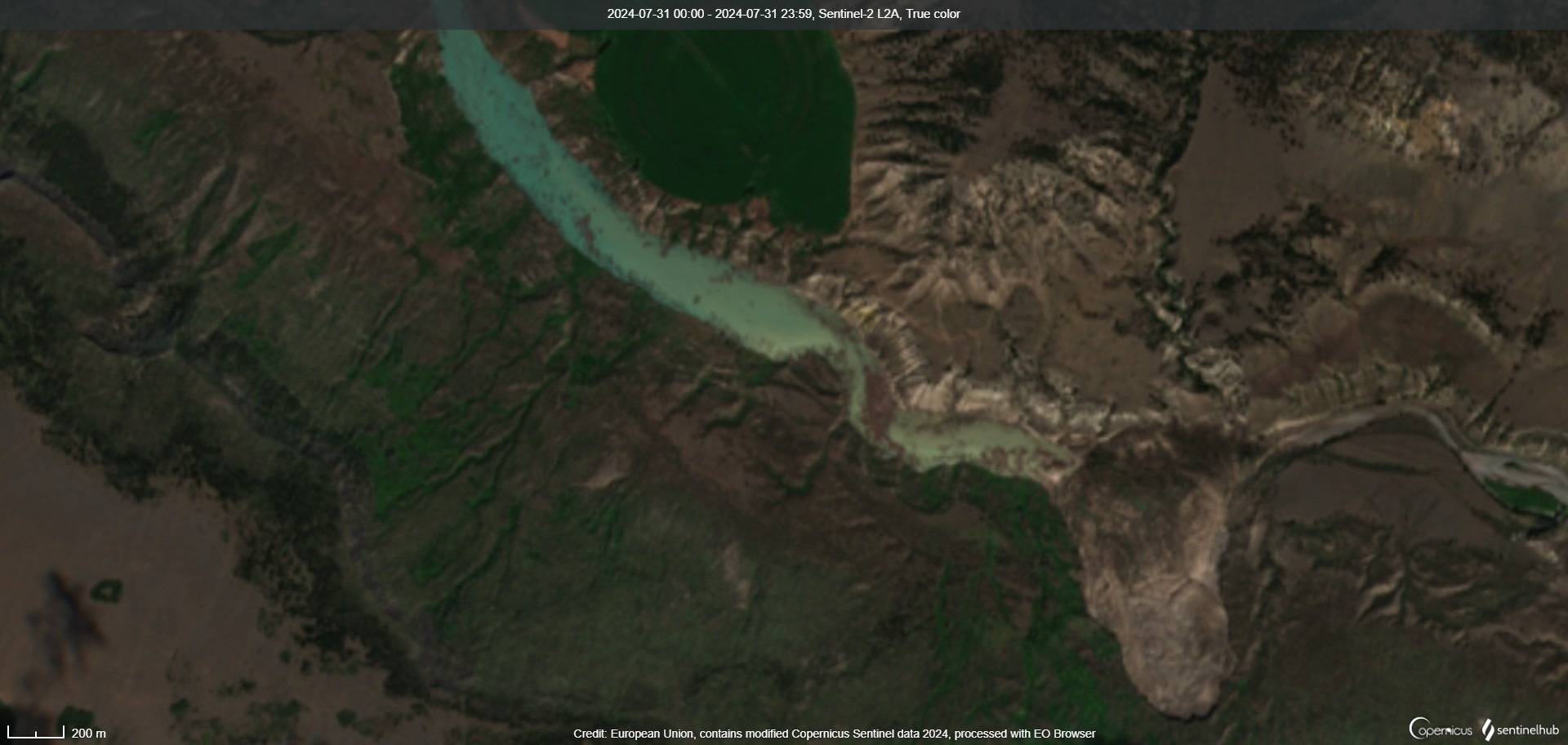
Interestingly, the Sentinel-2 satellite passed over the area at around 10:00 am PDT (July 31st) and was able to capture a complete cloud-free image of the area. In the image below we can see the landside on the bottom right, impounded water upstream of the landslide (left) and a dry river bed to the right of the landslide.
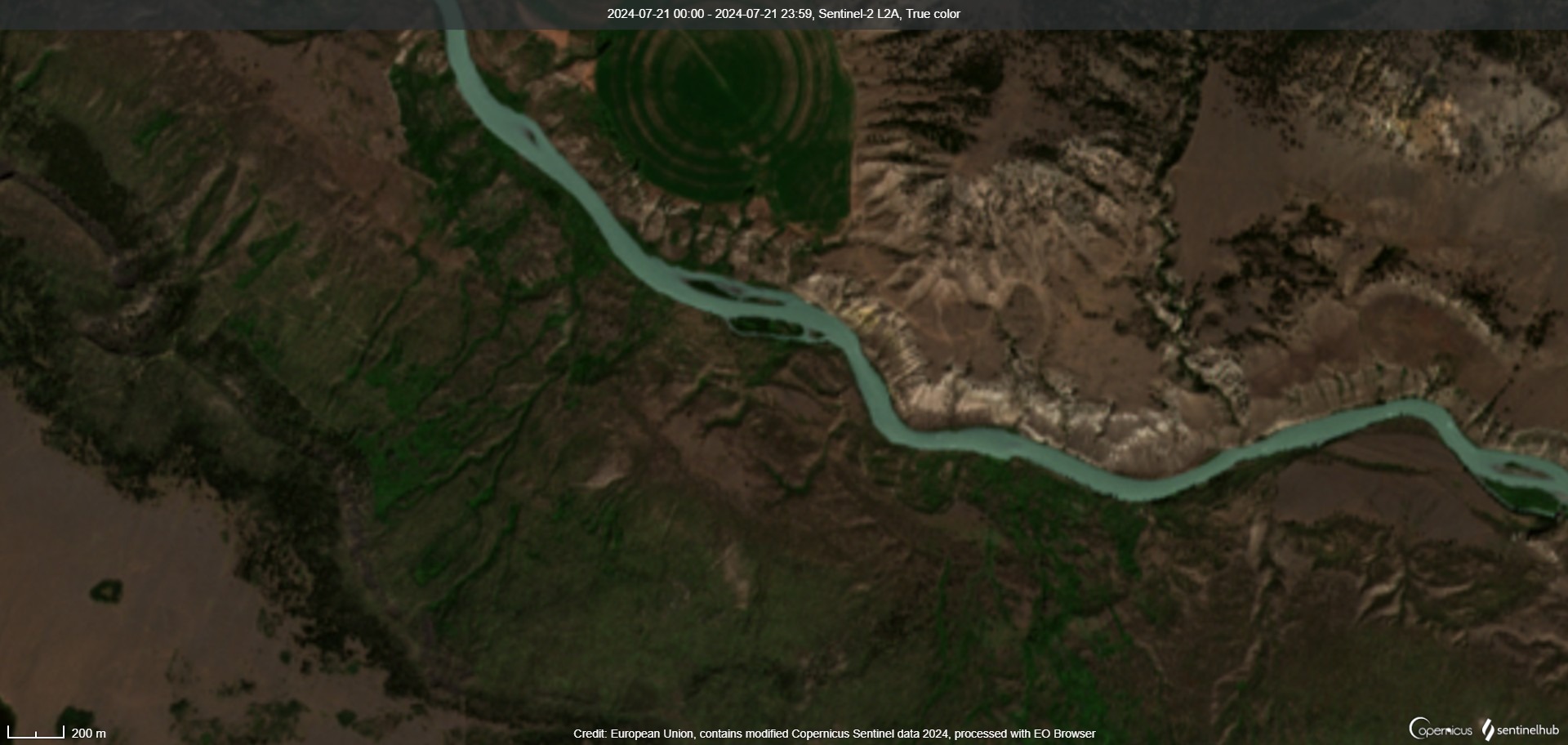
For comparison we also include a second reference picture from the previous week - July 21st, 2024 (before the landslide occurred). In this image, we can see the Chilcotin River running freely through the area. These images can be explored further on Sentinel-HUB (Chilcotin Landslide). Notice how the islands are completely submerged and the impounded river is climbing up the bank.
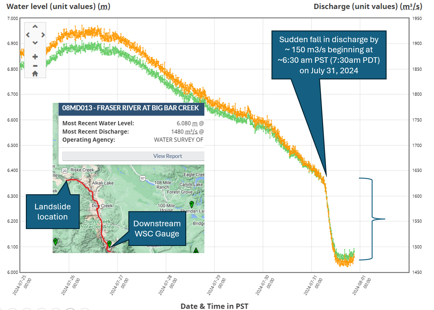
When did the landslide happen? How much water is being impounded? When will it blow out again and what will that look like? I don't have answers to the latter questions be we can look at Water Survey Canada (WSC) stream flow gauges downstream to try to identify when the landslide occurred and how much water is being impounded. Unfortunately, there aren't any real-time stream flow gauges in the immediate vicinity downstream of the landslide, but we can look at the WSC Gauge 'Fraser River at Big Bar Creek (08MD013)'. This gauge is located on the Fraser River downstream of the confluence point with the Chilcotin River.
The 'Fraser River at Big Bar Creek (08MD013)' gauge is located about 113.7 kilometers downstream from the landslide. 39.6 kilometers downstream along the Chilcotin River from the landslide to the confluence of the Chilcotin and Fraser River and then another 74.1 kilometers from the confluence of the Chilcotin and Fraser River to the stream gauge. The change in stream flow (signal in the hydrograph) is therefore expected to be delayed but still can be used as a rough estimate for the volume of water being impounded behind the landslide. The figure below shows stream flow (orange) at the gauge over time. At about 7:30 am PDT we see stream flow in the Fraser River suddenly drop by about 150 m3/s. The data for this stream gauge can be reviewed further on the WSC website.
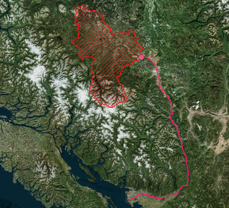
To get a sense of the location and magnitude we can plot the upstream basin area (red polygon above the landslide) and the downstream flow pathway through the Chilcotin River and into the Fraser River. The upstream basin area, above the slide, is roughly 16,789 km2. For comparison, the Fraser River (at the outlet to the ocean) is roughly 240,000 km2.
